Flood insurance: Part One
A friend said to me recently: “why don’t you write an article about flood insurance?”
Ah, if it were only that simple.
I do plan to write regularly on flood insurance, so please regard this as the first in a series. It does not have all the answers because the story is still unfolding. Two things to bear in mind are that flood damage is not covered under a standard homeowner policy and that flooding occurs throughout the country, not just in coastal areas.
I do have an important message at the end of this article for anybody who is paying flood insurance.
As a start here’s a short article explaining how the National Flood Insurance Program (NFIP) came into being in response to 1965’s Hurricane Betsy; how it was basically solvent until Katrina et al in 2005 created a $17 bn debt (the US Treasury pays the claims and NFIP is supposed to reimburse it from the premiums it collects) which after Sandy has risen to some $25 billion.
As usual, Congress reacted in knee jerk fashion after Sandy and quickly passed what became known as the Biggert-Waters Act, which in essence was a move to end the subsidizing of premiums for certain categories of insured properties. This, by the way, is separate from the introduction of new flood maps which are also due to come into effect shortly.
Now that the new flood insurance bills are going out, Congress is discovering the consequence of its legislation (does anybody in Washington ever read and understand the Bills they vote on? Sorry, silly question.)
This week bipartisan (!) Bills have been introduced to delay the implementation of the new insurance premiums until two years after FEMA completes an affordability study, which will take two years. And by the way, under Biggert – Waters, this study was supposed to be completed before the implementation of the new rates. Supposed to, but wasn’t.
Rep. Maxine Waters, D-Calif., who was a lead sponsor of Biggert-Waters, said she never envisioned the scope of some rate increases being implemented under the law. “From the moment I learned of the unintended consequences of the Biggert-Waters legislation, I have made clear that I would lead the effort to resolve the problems that have resulted,” Waters said.
It appears that the latest proposal will be part of Washington’s horse trading in January.
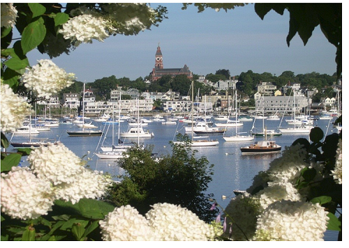
I listened to a conference on flood insurance this week and was astounded to hear a speaker explain that Massachusetts, which has so many older properties, could expect to pay higher premiums in future, while States like Texas and Florida would be better placed because so much of their housing stock was newer and built to higher standards. The speaker went on to explain that the housing stock was newer in those States because they had suffered so many devastating storms.
It did not seem to occur to this speaker that the reason our housing stock is older is because we have not suffered large numbers of damaging storms! The basic principle of insurance is risk: those with frequent losses pay more. I do not accept that homeowners who have never suffered a loss should pay more because they may do in the future.
Going back to my comment about flood insurance not being that simple. I thought I would try to find out the losses paid by NFIP by State. First I called FEMA. After being passed around like a hot potato, I was told to call the NFIP. You know where this is going, right? Yep, I was again passed around and finally told to call FEMA.
And now my message to anybody who is paying flood insurance premiums. I have been paying premiums since I bought my house 16 years ago. I receive a bill each year and pay it. This year I looked for the first time at the flood maps and discovered that my house is not in the flood zone!
Here is how to check:
Click on Marblehead Flood to go to the Town’s website
Identify your location and note the last four digits of the parcel number
Click on the link to FEMA’s website and enter MA and Essex County and click on the Get Preliminary Map button.
When you open the PDF it will be reduced to 22.5%. Enlarge it to 100% and locate your address, and then enlarge it further to 400%.
At 22.5% you can see that most of the coast of Marblehead is in Zone VE. Read FEMA’s VE definition
At first glance, therefore, all or most of our waterfront properties appear to in the flood zone, but when you enlarge the map you get a different story.
Let me be very clear: I am not offering any opinion about whether a specific property is or is not in the flood zone; and I am not making any recommendation about whether or not you should have flood insurance. I am merely suggesting that you can easily – well, fairly easily – find out the facts. And you know how much I like facts.
If you have difficulty in making sense of the online maps, then you can go to the Engineering department at the Mary Alley and they can show you your property.
So first move is to get the facts.
To be continued.
If you are considering buying or selling a home and have questions about the market and/or current home prices, feel free to contact me on 781.631.1223 or andrew@HarborsideRealty.com.
Andrew Oliver is a Realtor with Harborside Realty in Marblehead.
Andrew,
this is such a good article. I have so many clients who are calling me to find out about the impact this new bill will have on their flood insurance rates and I feel you have provided some practical tips on how to determine your position on the new FEMA flood maps and more information on the bill itself. Thank you and this is just invaluable research that you share with us. I appreciate your insights on this major issue for all of the North Shore.
Thanks for taking this on..
Thank you. I look forward to the ongoing story. Or should I say misadventure